Posts

Showing posts from April, 2018
Image
Our final project was an independent poster designed to solve a problem of our choosing. The issue I decided to address was biking in Auburn, AL and the possible benefits that could come with it. In large, the poster displays the project itself, but the take home message from it all is that by designing safer biking roads in a proactive manner, we can also create ecosystem services such as carbon sequestration, water filtration and retention, and beautify auburn by incorporating green infrastructure into its design. Auburn has already mentioned in the city council meeting at the end of 2016 that they intend to not only work on transportation in the city of Auburn, but also intended on repaving bike ways and roads as things stand. Why not take it a step further and make Auburn a model in green infrastructure?
Climate change through the lens of GIS

Image
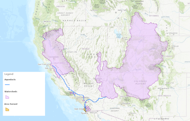
Climate change is a relatively loaded phrase that encompasses many things working together to alter the environment. This is a very heated topic but one that I believe to be very important for us to understand, as our surroundings are changing and we need to be prepared for what that means. It just so happens I'm working on a side-project regarding alternatives to desalination which could provide various benefits if it comes to fruition, most notably would be a convenient alternative to obtaining so the very-limited fresh water we need for survival. That said, the focus of my project was that under the hypothetical that desalination becomes more prevalent (one way or another) - what impact would it have on the environment? To predict this solution, I aimed to answer a number of questions: Where is the water coming from? What is it used for? What if we altered the use of the water - what would happen to the excess? What land would be converted to alternative land use? Ben